A LADRAM LOOP
Spectacular views of the Jurassic Coast, a premier league nature reserve, with a sprinkling of history thrown in.
Over on my Lakes and Dartmoor blog, I introduced “Over the Hill Hikes” (OTHHs): defined as walks designed for those, like me, who are past their peak bagging peak, but still keen to enjoy a few more decent hikes before hanging up their boots
This is the first in a series of OTHHs describing circular walks off the South West Coast Path (SWCP), mainly in south Devon, an area where I live and know best.
This walk, from the sedate coastal town of Budleigh Salterton, follows the coast path to a picturesque cove, then strikes inland to visit an old mill before returning through a nature reserve along the banks of the River Otter.
For quite a modest walk we will explore a rich diversity of countryside: revealing spectacular cliff, river and farmland scenery. We should perhaps expect something a bit special when we consider that the route takes us through several protected areas – including an Area of Natural Beauty, a National Nature Reserve, a Site of Special Scientific Interest, a World Heritage Site and a Marine Conservation Zone.
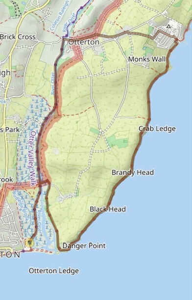
| START/ FINISH | Lime kilns car park (Grid Ref 074820), at the eastern end of the sea front at the mouth of the River Otter. |
| DISTANCE | 7.25m |
| ASCENT | 845 ft. |
| TERRAIN | Good paths and a short section on metalled roads from Ladram Bay to Otterton. The path along the river is well-used and can be muddy in wet weather. |
| PUB | The Salterton Arms, 22 Chapel St, Budleigh Salterton EX96LX. |
Salt panning was carried out hereabouts since the Romans and the town owes its name to the “salters” who in medieval times made their living working for the Abbot of Otterton Priory. The car park got its name from the lime kiln that can be seen near the entrance.
We can look seaward before leaving the car park for another glimpse into the past. The large ridge of pebble between us and the sea was formed by a massive storm in the 16th century, which resulted in the river silting up: remarkably, before this obstacle was created boats could travel up the estuary to Otterton.
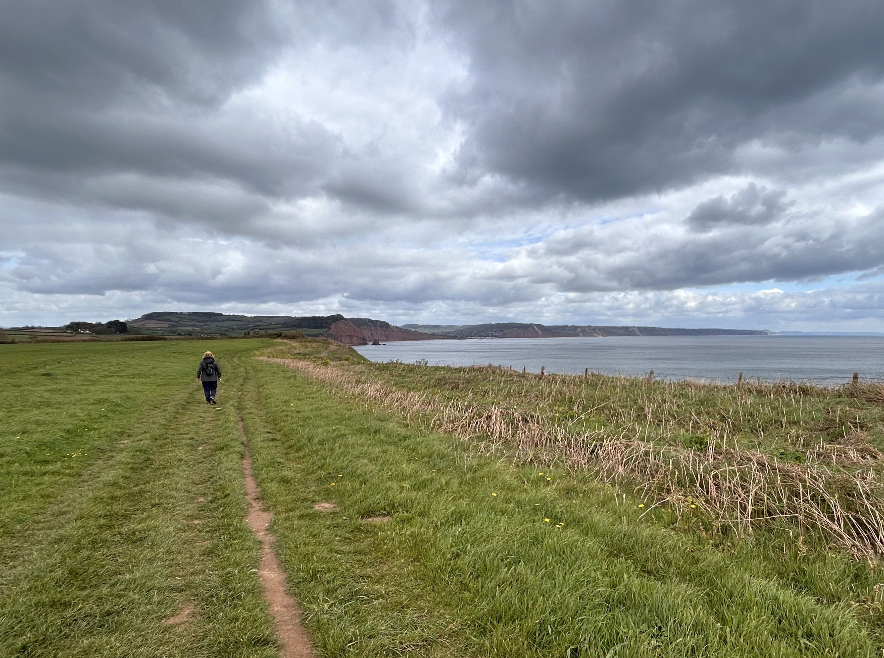
BUDLEIGH SALTERTON TO LADRAM BAY
After reflecting on Budleigh’s past we immediately encounter the present, in the form of the new Queen Elizabeth Bridge that we cross after leaving the car park on the SWCP, heading inland along the river. This bridge is part of the Lower Otter Restoration Project, a £27m scheme aimed at reducing the impact of rising sea levels due to climate change by connecting the river with its historic floodplain and creating a new inter-tidal wetland habitat for a variety of wildlife. This ambitious project took over a decade to plan, fund and deliver and was carried out by the Environment Agency in Partnership with Pebblebed Heaths Conservation Trust, who manage the land around the estuary on behalf of the owners, Clinton Devon Estates.
The estuary lies in the East Devon Area of Outstanding Natural Beauty and was already a Site of Special Scientific Interest before being designated the Otter Estuary National Nature Reserve in 2024, on completion of the restoration project: it was thus accorded the highest level of conservation possible under UK legislation. The new reserve combines the rare heathland of the existing Pebblebed Heath National Nature Reserve with the 90 hectares of newly created wetland in the estuary. It was the third in the “King’s Series” of national nature reserves promoting natural connections and biodiversity and is managed by the Pebblebed Heath Conservation Trust.
The reserve provides additional habitat for rare and declining wetland birds and attracts a rich diversity of other wildlife. Over 120 species of birds have been recorded on the site, including waders such as oystercatchers, curlew, godwits, avocet and plover. Swallows, swifts house martins, kingfishers and warblers are also found here. The rushes, reeds and abundant wildflowers attract insects, including dragonflies, damselflies and butterflies. All of this wildlife can be observed from two viewing platforms on the west side of the estuary and a bird hide on the east bank.
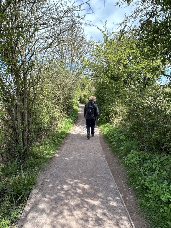
After just over half a mile we reach a bridge, which we cross, remaining on the SWCP and continuing down the eastern side of the river. It’s a pity there’s no crossing at the mouth of the river: however, we should not be tempted to save a mile of walking by trying to wade across, as it’s dangerous, even at low tide.
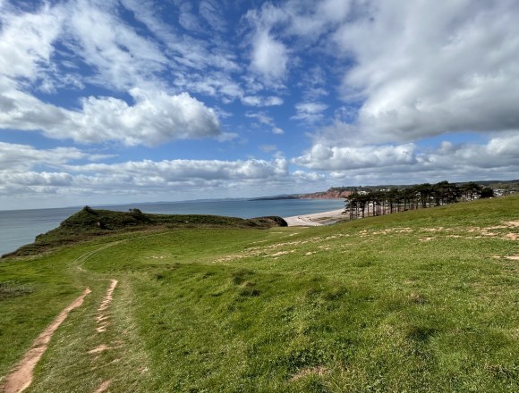
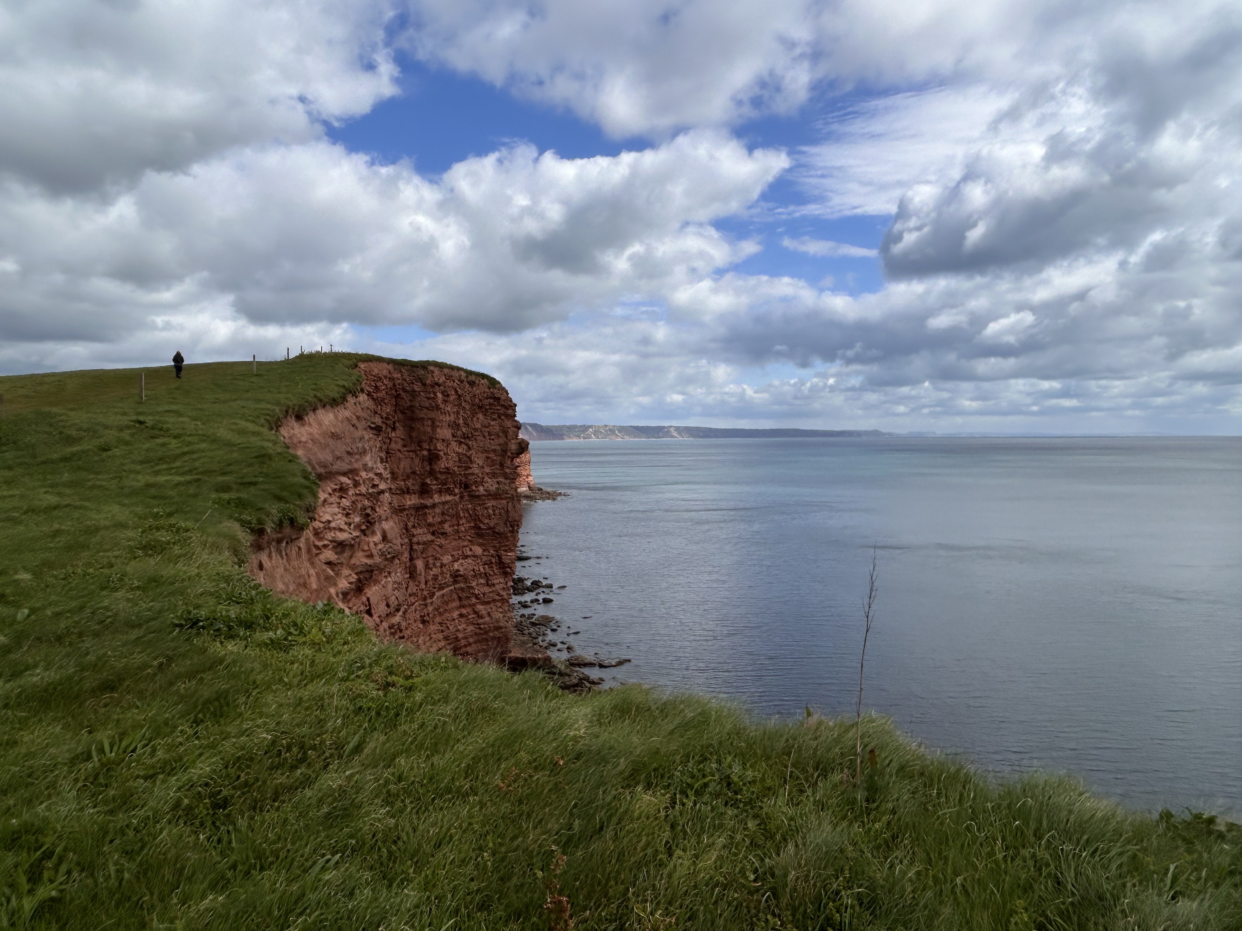
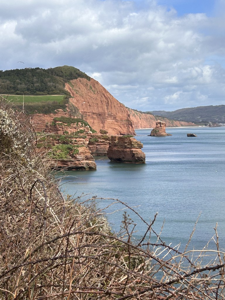
When we finally return to the coast we turn left, heading for Ladram Bay along the top of the signature red sandstone cliffs which form the oldest section of the Jurassic Coast World Heritage Site. While not the most demanding bit of the SWCP, our coast walk does reward us with magnificent views in both directions and passes an interesting former observation post on Brandy Head, the name a reminder that in times past this stretch of coast was haunted by smugglers. During WW2 fighter aircraft were observed from here testing mounted cannon and gun sights by strafing targets positioned off the headland.
Until recently this building was a perfect place to shelter in bad weather or to sit and have a rest and a buttie in any weather: however, recently it has been converted to a holiday let, although there are still covered benches outside for the weary rambler. From here there are spectacular views across Chiselbury Bay towards Portland in the east and Torbay in the west.

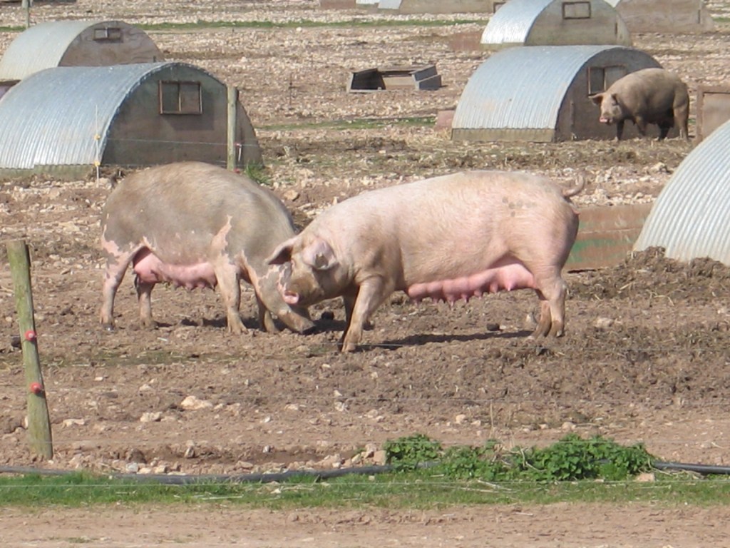
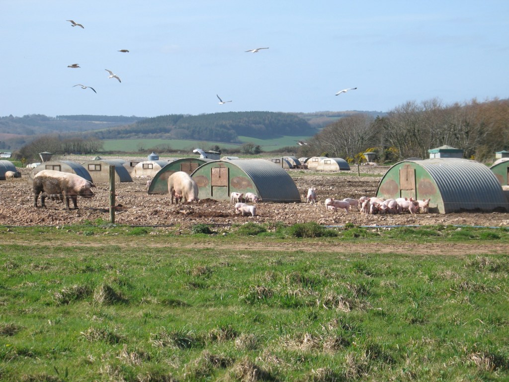
When I first walked this path a large pig farm was perched in an exposed position on top of the cliffs, but this has long since disappeared. I miss it, as I enjoyed watching the residents going about their business (and sometimes joyously rolling around in it, happy as pigs in shit clover). I like to think that my porcine pals enjoyed their stay in what looked like first class (for pigs) cliff top accommodation before ending their short, but happy, lives as bacon sandwiches or full English breakfasts.
After the unspoilt peace and tranquillity of the coast path, Ladram Bay provides something of a shock to the system since – as well as its very photogenic cove, pebble beach and sea stacks – it hosts Ladram Bay Holiday Park, which seems to expand every time we walk through it. There has been a caravan site here since the 1950’s and it is now the second largest holiday centre in Devon, offering accommodation ranging from tents to luxury lodges with hot tubs.

LADRAM BAY TO OTTERTON
After visiting the cove, we must escape from the caravan site. After walking uphill for a while on the left-hand side of the access road (named Bay Road on the OS map), we turn left at GR 094854 and follow a track that cuts off the corner at the top of Bay Road, taking us to Ladram Road at GR089853. Here we turn left and walk downhill to enter Otterton, turning left onto Fore Street, the main road through the village.
From when the Saxons first arrived, until the Tudor period, there was a harbour at what was then known as Ottery Haven. In medieval times, before the river silted up, this was a busy port with a thriving wool industry, after which agriculture became the main industry. In “The Buildings of England” Nikolaus Pevsner described it as “an instructive example of local building from the 16th century onwards”. Today, the picturesque cob and thatched cottages make it a highly desirable place to live and for tourists to visit.
Towards the end of Fore Street, just before the road crosses the River Otter, we pass Otterton Mill on our left and St Michaels Church on our right.
In 1086 St Michaels Church was recorded in the Domesday Book as belonging to the monastery of Mont St Michel in Brittany, one of many properties given to nobleman and monasteries from across the channel after the Norman conquest. The monastery had supported William and was rewarded with this and other properties and land in England, including St Michaels Mount in Cornwall. The church you see here today was re-built in 1869-7.
Crossing the road, Otterton Mill is worth a visit. This working water mill was also part of the estates given to the Monks of Mont St Michel and was recorded in the Domesday Book as the largest and most productive of 70 water mills then operating in the Otter Valley. It is thought that there may have been a mill here a thousand years earlier than this, in Roman times. Milling stopped in 1989 and the buildings were used for grain storage, but it was restored in 1988 and has operated ever since as a popular local attraction, with a restaurant, shop, bakery (artisan naturally), arts and craft gallery and thriving music venue.
OTTERTON TO BUDLEIGH SALTERTON
After perhaps treating ourselves to an artisan loaf and jar of jam from the mill, we cross the bridge and drop down off the road to the riverside path that will return us to the car park in Budleigh. The former East Budleigh Station (which was far closer to Otterton) is the single-story red brick building just across the river at this point: the platform and station building surviving as a private house.
Just over half a mile along the river, at GR078842, we pass “Clamour Bridge”. This footbridge is thought to have replaced an earlier bridge formed of a stone slab. Such slab bridges were known locally as “clams” or “clammers”, hence the name.

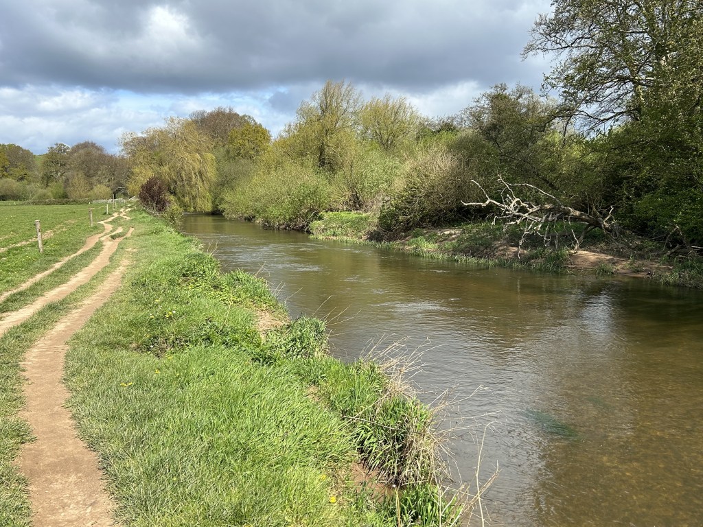

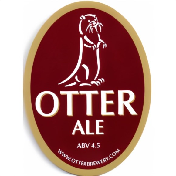
Naturally enough, the River Otter is a good place to spot otters, but it also plays host to a breeding population of beavers. The species died out in Britain around 1550 and, like many recent immigrants, the beavers of the Otter have had a hard time being accepted by everyone.
A few beavers were first noticed in the river in 2013 – no one knows how they got there – but they weren’t popular with everyone. Three “kits” were born in 2014 whereupon landowners, anglers and farmers expressed concern that they could carry disease and the government initially announced that they would be captured and put in zoos or wildlife parks. This triggered protests by local residents and environmental groups who pointed out that beaver’s dams are beneficial in providing habitat for birds and fish and in helping prevent flooding. These arguments won the day and in 2015 Natural England announced that they could stay for a trial period. In 2020 the government extended their stay indefinitely. By then there were 15 family groups.
Finally, we reach the bridge we walked across on our way out and carry on straight ahead to the car park. Those of a more adventurous, or indeed exhibitionist, disposition may wish to walk to the western end of the beach where, transitioning from naturalist to naturist we can dispense with our clothes. When I first walked to Budleigh from Exmouth I wondered why an old chap was perched precariously on top of a cliff peering intently towards the beach. I assumed he had spotted a rare bird, which I suppose might have been the case in more ways than one.
If you’re in need of refreshment, there are a few tea shops in Budleigh and a nice traditional pub, The Salterton Arms, where if you haven’t seen an Otter, you may be able to drink one.
DISCLAIMER
I can take no responsibility for any loss or injury caused by following the above walk. The description is an accurate outline of the route and should enable you to follow the walk on an OS map, but the walk should not be attempted without a map, compass and the ability to use them!

4 replies on “OVER THE HILL HIKES ON THE SWCP #1”
Sounds idyllic Steve. Plenty of interest and some lovely views.
LikeLike
A very good description of land and history, brought to life on what appears to be an interesting circular ramble, one I must do at some point. Thanks
LikeLike
Agree totally with the last comment, a very good description of a walk – and one which I have walked previously
LikeLiked by 1 person
Thanks Steve
LikeLike